
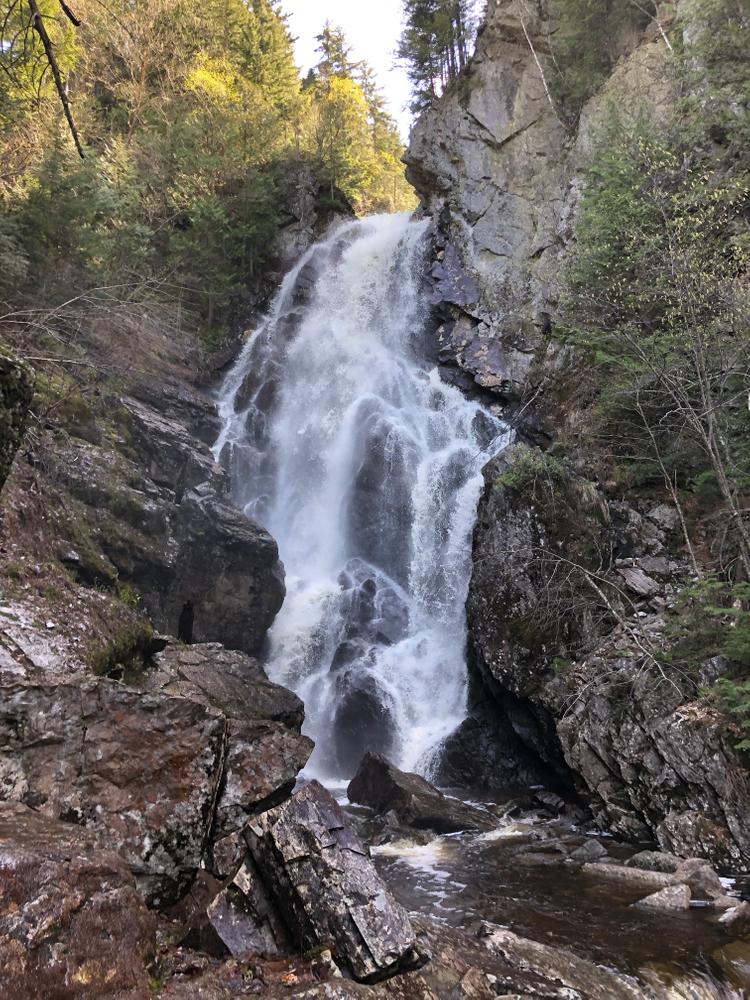
(T.R.A.C.) With a 90-foot “hanging” plunge, the water creates the shape of an angel’s wing and is one of the most impressive waterfalls in Maine. Finding the trailhead is a bit of a challenge and you’ll want to consider water flow when you’re wanting to go. There needs to be enough water flow for the falls to be full/pretty, but not so much water flow that it makes stream crossings impossible or unadvisable. This is about a 1.1-mile hike with a bit of elevation gain and there are several stream crossings so make sure those in your party are sure-footed and up for the fun/challenge of rock hopping over a flowing stream.
Directions: From Oquossoc village, take Route 17 South for about 18.5 miles. You’ll have been traveling ‘downhill’ from the Height of Land for quite a while and when it flattens out, immediately look for a dirt road with a bridge at the start of a large field on the right. This bridge crosses the Swift River (you should see a sign), follow this road for about 3.5 miles and look for a road on the left going downhill (44.7902, -70.7079, if you’re so inclined!). Follow it into an old gravel pit (there will be a large boulder with graffiti), and park here. From the parking area, look for red blazes and follow a logging path across Berdeen Stream. Continue following the red-blazed trail to Mountain Brook. The trail follows up the stream and crosses several times before you come to the falls.